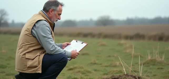
Converting 6 ares to square meters takes just a few seconds. Understanding what these square meters actually allow you to do on a plot of land requires more work. The conversion is based on a simple rule, but the raw area of a plot says very little about its buildability or development potential.
Conversion table: ares, square meters, hectares
The three units of area used for land in France are the are, the centiare, and the hectare. They are all derived from the square meter by a factor of 100.
| Unit | Equivalent in m² | Relation to the are |
|---|---|---|
| 1 centiare (ca) | 1 m² | 0.01 are |
| 1 are (a) | 100 m² | 1 are |
| 6 ares | 600 m² | 6 ares |
| 10 ares | 1,000 m² | 10 ares |
| 1 hectare (ha) | 10,000 m² | 100 ares |
The calculation is linear: 1 are = 100 m², so you just need to multiply the number of ares by 100. For 6 ares, you get 6 x 100 = 600 m². The reverse conversion works by dividing by 100: 600 m² / 100 = 6 ares.
Notarial deeds and cadastral documents often express areas in ares or centiares. Real estate listings, on the other hand, favor the square meter to facilitate comparisons between plots. To better understand what this area represents in practice, check out this conversion of 6 ares to square meters. 6 ares place a plot of land in the category of small parcels, typically an urban garden or a buildable lot in a residential area.

Raw area and buildable area: why 600 m² does not mean 600 m² usable
Having 600 m² on paper does not guarantee that you can build on the entire area. Several regulatory mechanisms can reduce the area that is actually usable.
The PLU sets the rules of the game
The local urban planning plan of the municipality defines, plot by plot or by zone, the rules for the placement of constructions. A plot classified in zone U (urban) does not offer the same rights as a plot in zone AU (to be urbanized) or in zone A (agricultural). Before any project, reading the zoning regulations of the PLU is the first step.
The PLU also imposes a ground coverage coefficient. On a plot of 600 m², if the maximum allowed coverage is limited to a fraction of the area, the construction will have to settle for a reduced footprint. Mandatory setbacks from property lines and roadways further encroach on the available space.
Easements that reduce the plot
Public or private easements can render part of the land unbuildable. On a 600 m² lot, the impact is proportionally heavier than on a larger plot.
- Right of way: a right of way for the benefit of a landlocked neighbor may cross the land and prohibit any construction on the affected strip
- Utility easement: a water pipeline, an underground electrical cable, or a sewage collector impose a no-build zone on either side
- Easement related to a risk prevention plan (PPR): in flood-prone areas or in clay shrink-swell zones, specific regulations limit the footprint or depth of foundations
On 600 m², a right of way a few meters wide can significantly reduce the buildable area.
Check the buildability of a 6-are plot before purchase
The conversion to square meters is just the starting point. To know what a 600 m² plot actually allows, several documents must be consulted.
The urban planning certificate (CU) is the reference document. The information CU (CUa) indicates the applicable rules for the plot. The operational CU (CUb) goes further: it specifies whether the proposed project is feasible on this specific land, considering the current regulations and existing facilities.
Requesting an operational urban planning certificate before signing a preliminary agreement protects the buyer from unpleasant surprises. The town hall has two months to respond, which requires anticipating the process.
Boundary marking and surveyor’s report
Cadastral areas are fiscal areas, not geometric areas. The discrepancy between the area indicated in the cadastre and the actual area measured by a surveyor can reach several dozen square meters on a plot of this size. A contradictory boundary marking, conducted in the presence of neighbors, definitively establishes property boundaries.
This point is even more sensitive on a 600 m² plot, as a discrepancy of a few square meters can push a project below a regulatory threshold (minimum land area required by the PLU for construction, for example).
6 ares in m²: what this area concretely represents
To visualize 600 m², a few references help to picture the plot. A 600 m² plot corresponds approximately to a rectangle of 20 m by 30 m, or to a square of about 24.5 m on each side.
- In a residential area, 600 m² accommodates a single-family home with a modest-sized garden
- In a rural setting, this area corresponds to a large vegetable garden or an orchard with several dozen fruit trees
- In horizontal co-ownership, a 600 m² lot allows for a house with a garage and a private outdoor space
600 m² is sufficient for an individual residential project, provided that local urban planning constraints do not significantly reduce the effective buildable area. In municipalities where the PLU imposes a minimum land area per housing unit, 6 ares may be just above or just below the threshold, which makes all the difference.
The arithmetic conversion remains trivial. What differentiates a successful purchase from a costly mistake is the systematic verification of the PLU, easements, and the actual boundaries of the plot before committing. A well-located 6-are plot free of constraints offers real potential. The same plot burdened with easements or poorly classified in the PLU can turn out to be largely unbuildable.